


Research Team


Aditya Bhaskar Bhagat
Technical Assistant
Ajeet Singh Gaharwar
Technical Assistant
RESEARCH AREAS
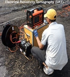
- Soil Characterization: Advanced laboratory testing methods to assess soil properties, near surface geophysics (MASW & ERT) and subsurface investigation.
- Computational Geotechnics: Constitutive modeling, developing sophisticated numerical models to simulate complex soil behavior under various loading conditions.
- Foundation Engineering: Design of suitable foundation systems for difficult terrains and ground conditions.
- Geotechnical Earthquake Engineering: Ground response analysis, liquefaction and re-liquefaction susceptibility.
- Environmental Geotechnics: Fly-ash embankment design, reclamation of abandoned fly ash ponds, solid industrial waste such as red mud utilization.
- Ground Improvement Techniques: Geo-synthetics, geo-textile, geogrid reinforcements, stone columns, granular anchor piles and grout mixing for enhancing soil strength.
- Geohazards: Geo-investigations (geological, geophysical & geotechnical), landslide hazard-vulnerability-risk assessment, landslide dynamics through instrumentation and monitoring, landslide modeling, landslide early warning system (LEWS), debris flow modeling (experimental & numerical), rockfall modelling, rock-ice avalanche modelling, UAV based landslide mapping & monitoring, remote sensing & GIS applications, post-disaster need assessment, design of mitigation measures such as retaining walls, gabion walls, reinforced soil and rock slopes.
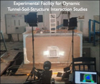
- Rock Engineering: Stability analysis of natural and cut-slopes, opencast mine design, underground space and tunnel Engineering, dynamic tunnel-soil interaction.
- Risk Assessment and Reliability Analysis: Incorporating uncertainties into geotechnical design to assess potential hazards and optimize safety factors.
- Deep learning and AI applications: Fast computing techniques, use of AI/ML in various aspects of geotechnical engineering.
MAJOR FACILITIES
- Digital Image Processing and GIS
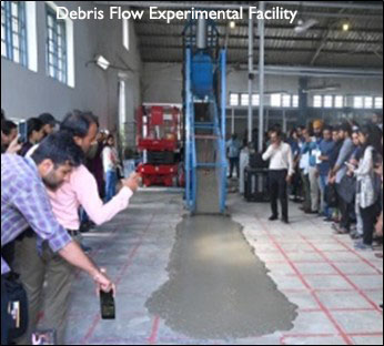
- Test Flume for Debris Flow Modelling
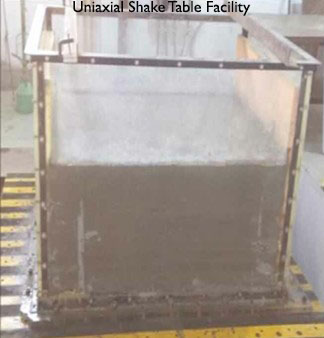
- 1g-Uniaxial Shake Table
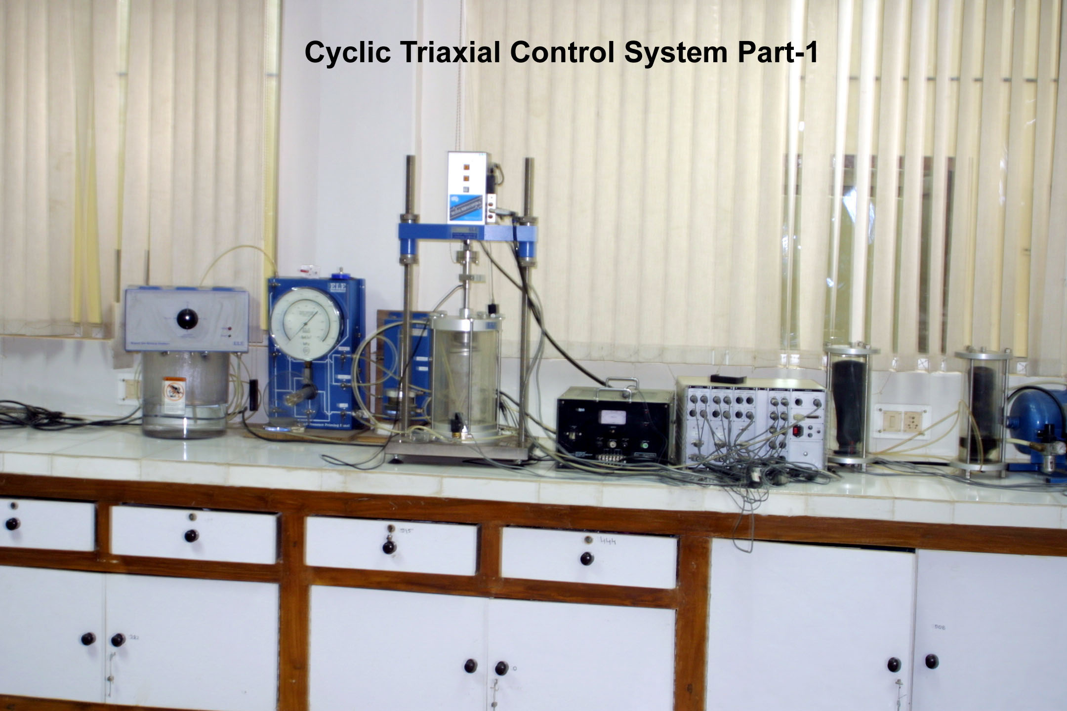
- Cyclic Triaxial and Consolidation Testing
- Geosynthetic Tensile Testing Machine
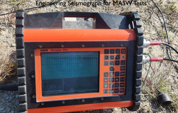
- Engineering Seismograph, Resistivity-meter and GPR
- Foundation Pile Diagnostic System
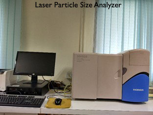
- Laser Particle Size Analyzer
- 2D-Digital Image Correlation System
- Large scale rainfall induced landslide modelling test flume
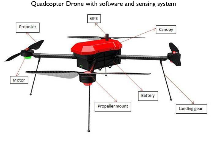
- UAV for Landslide Mapping
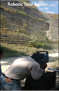
- Robotic Total Station for Surveying and Monitoring
- MATLAB, RAMMS, FLAC3D, PLAXIS 3D, GEO SLOPE, GEO5, UDEC, ArcGIS, MIDAS GTS NX
ONGOING PROJECTS
International
Industry
Government
-
- Landslide Mapping, monitoring and early warning using optical imaging drone and geo-integrated rainfall threshold based models along National Highway corridor of Bhagirathi Valley, Uttarakhand, India
- A Draft Guideline on Safety and Mitigation Measures for Buildings and Infrastructures in Landslide-Affected Areas
- Technical Textiles as Sustainable Building Materials for Various Structural, and Geotechnical Applications in Construction
Research & Development
COMPLETED PROJECTS
Industry
-
- Technical guidance on the safe demolition of Supertech Twin Tower, Noida
- Vetting of the structural and ground improvement measures for the distressed passenger cum station building in Nischintapur Yard, Akhaura, Agartala
- Design of retaining and drainage structure at Pakyong Airport, Sikkim
- Design Assessment of BCIS Pile Foundation of Indore Metro Rail Project
Government
-
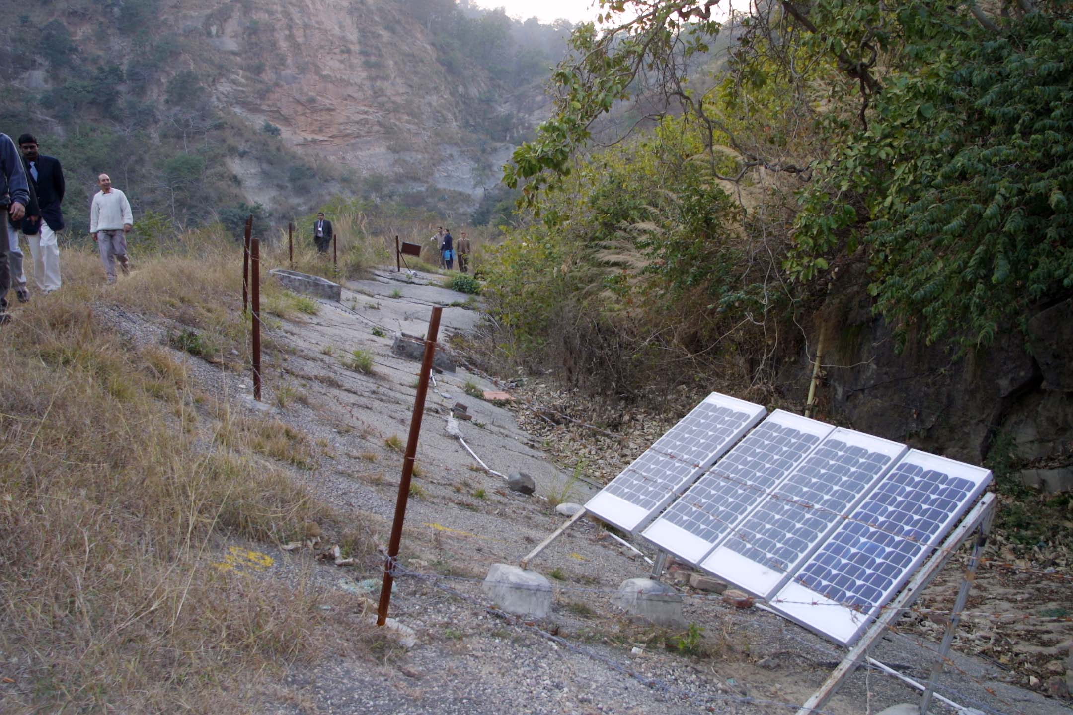
- Evaluation and design of low-cost ground instrumentation with real-time monitoring for the development of landslide early warning system
- Stability analysis and remedial measure design for landslide mitigation below Nagaland Ligislative Assembly, Kohima-Thizama road, Kohima, Nagaland
- Installation of Landslide Monitoring System at NLA Landslide site, Kohima,Nagaland
- Geo-investigation, stability assessment and remedial measures for Gadora Village landslide area, Uttarakhand
- Rock mass characterization and numerical modelling of slopes subjected to blast loading
- Engineering solution for soil erosion Prevention of Traverses
- Multi-channel analysis of surface waves (MASW) and site response study for the Statue of Oneness project site at Omkareshwar, Madhya Pradesh
- Behaviour of Shallow Foundation on Randomly Distributed Fibre Reinforced Fly-ash (RDFF)
Research & Development
-
- Geotechnical Novel Solutions for Underground Infrastructures
- Multi-temporal Optical Imaging Drone based Landslide Monitoring and Warning
- Effectiveness of Contiguous Piles in Minimizing the Urban Tunnelling induced Settlement in Layered Soil
For further details, please contact:
Dr. D. P. Kanungo
Head
Geotechnical Engineering & Geohazards Group
Phone : +91-1332-283417
Email : dpkanungo [at] cbri.res.in