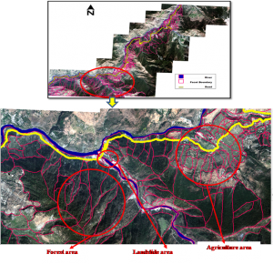
Task – 1.1:
Landslide Hazard and Risk Assessment of Chamoli-Joshimath region, Garhwal Himalaya
Task Leader:- D.P. Kanungo
Objective:
The proposed task will focus on large scale landslide hazard and risk mapping in Chamoli-Joshimath region of Garhwal Himalaya
Scope of the Work:
- Geological & geo-morphological data base generation through field mapping and remote sensing data analysis & interpretation.
- Geotechnical database for rock and debris landslides and other representative pockets in the study area through field and lab investigations.
- Development of methodology for spatial prediction of rock and debris landslide hazard.
- Preparation of landslide hazard maps in GIS.
- GIS based mapping and integration of travel/flow path and zone of influence of landslides in the hazard maps.
- Risk element mapping using available information & remote sensing data.
- Preparation of landslide risk maps in GIS


