Task – 1.3 :
GPS based Integrated Landslide Modelling for hazard assessment
Task Leader:- Sridevi Jade, M.S.M.Vijayan
Objective:
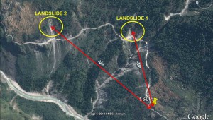
To develop a methodology and Integrated landslide model for hazard assessment in landslide prone zones of Chamoli-Joshimath region of Garhwal Himalaya based on movement pattern/dynamic behaviour of landslides using differential GNSS.
Scope of the Work:
- Identification of study area by preliminary survey, equipment purchase and staff recruitment.
- GNSS measurements in the selected study region and identification of active landslide areas.
- Repeat GNSS measurements, identification of a active landslide if any for modelling.
- Repeat GNSS measurements and Integrated modelling.
- Development of models and documentation.


