Task – 1.4:
Landslide Monitoring using InSAR
Task Leader:- S.K. Mittal
Objective:
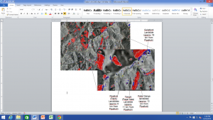
The objective of proposed activity is to study the selected landslide site using InSAR and to correlate findings with other methodology (like GPS, optical fibre, Instrumentation, bio-measure) being followed by other participating labs.
Scope of the Work:
- Finalization of vulnerable locations of selected site in association with participating labs
- Procurement of Satellite imagery of selected Landslide site
- Procurement of required InSAR-image processing software with add on module for SAR interferometry application, high end workstations & Tough Notebook etc
- Study of the selected site
- To correlate InSAR finding with other methodologies being followed by other participating labs


